This is an old revision of the document!
Data
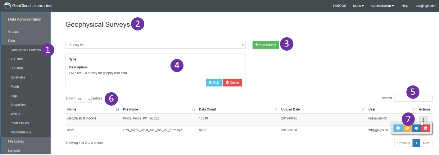
Datainformation When you click on Data, the data administration center opens (Figure 1) and a menu to the left shows the different data categories available on the GeoCloud. These are data types that can be handled (shown) in the GeoCloud Data Map. The page also gives a detailed overview of data (including meta data) uploaded to the GeoCloud: By clicking on one of the categories in the menu to the left (#1), a list of data is shown (#7). Data can be deleted or downloaded from the data list as well and filtered by file names (#5). If many data exist, the number of entries shown can be adjusted (#6).

Figure 1: Data Administration page / Data: Geophysical Surveys (example).
