Quality assurance
1. Download data for quality control
When a regular user checks in model changes for quality control, all quality control users and administrators receive an email.
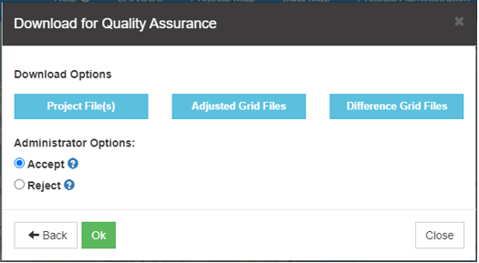
Click the model area polygon and “QA Download”.
You can download
- • Project File(s), i.e. Access interpretation point database and the documentation .zip file (if uploaded).
- • Adjusted Grid Files, i.e. the grids defining the changed model.
- • Model difference Grids, i.e. the difference between the model as it is now in the GeoCloud and the uploaded changed model.
2. Check the adjustments
Use GeoScene3D, the uploaded interpretation database, the model difference grids, optional documentation, etc. to assess the quality of the new changed model.

3. Accept or reject the model changes
If you accept the adjustments check on the “Accept” button, and press “OK”. The new adjustments are now added to the model, and the update model process starts. When the LARCOS database update is finished an email is sent to the users, and the model area is automatically released. The adjustment is now a part of the LARCOS model.


If you reject the adjustments check on the “Reject” button, write a comment (optional), add a .zip file with documentation (optional) and press “OK”. An email is automatically sent to the Regular user, who did the model changes. The regular user can now see that the adjustment has been rejected and download documents (if any), and may adjust the changes and check in later.


